
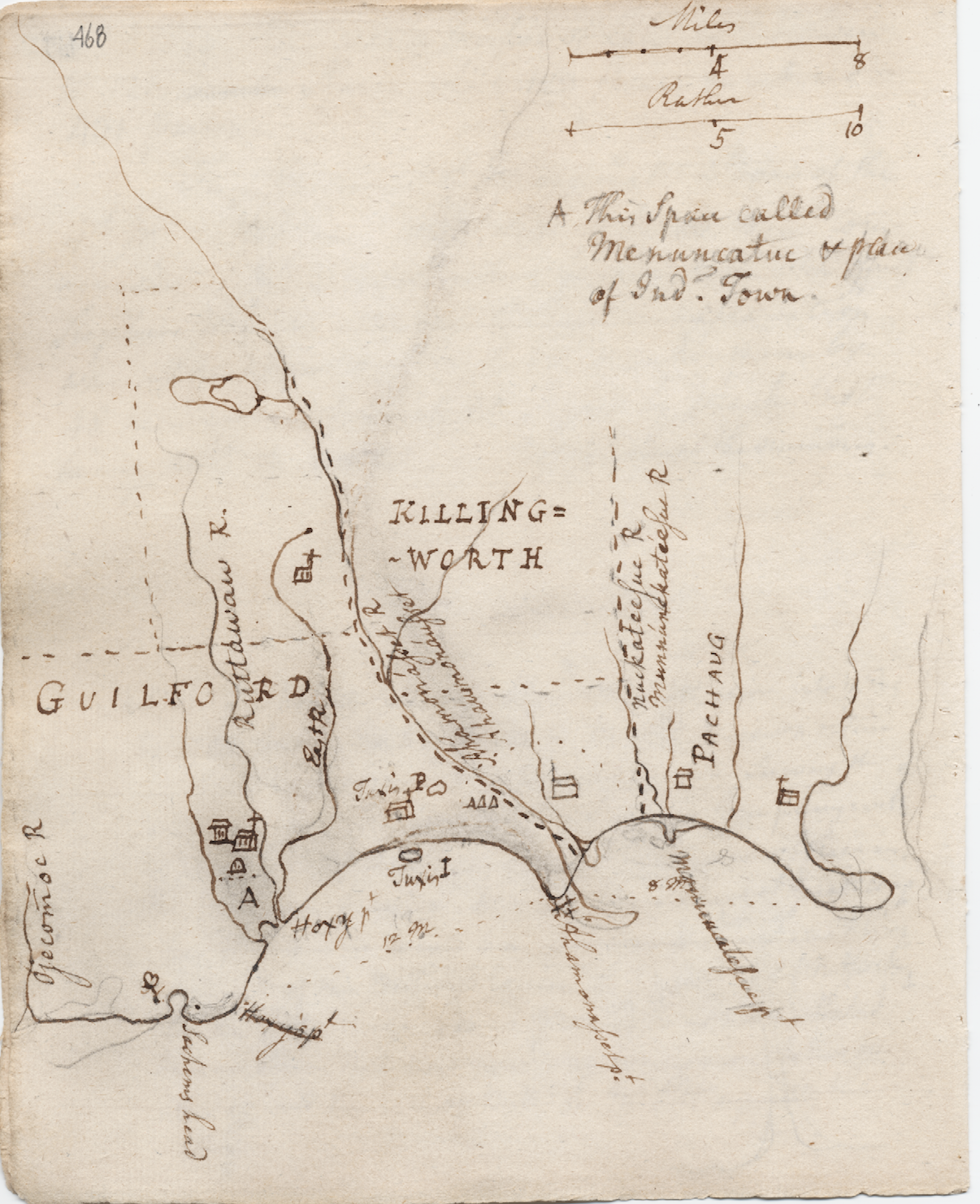
Ezra Stiles (1727-1795), the influential minister, scholar and president of Yale College, had a knack for writing things down. Nothing escaped his attention. His notebooks, journals, and correspondence often included the Native world around him. This world fascinated Stiles, who tried to reconcile the Native presence within his understanding of science, geography, politics, and philosophy. As a consequence, it is not uncommon to find among his papers, population counts and informal censuses of Indian communities, interviews with Indians that probed into their political, social, and cultural life, as well as stories and reminiscences about Indians from an older generation of colonists. However informative those materials may be, one of the more significant contributions to our knowledge of eighteenth century Native New England is Stiles’ maps of Indian places, which can be found interspersed throughout his papers.
In this document, the ever-inquisitive Stiles provides a map of the coastal towns of Guilford and Killingworth, Connecticut, some of which is present-day Madison. Churches or meeting houses are noted by icons of houses with a cross atop them. The area marked with the large letter “A” represents the Indian town at Menuncatuc (Menunkatuck). According to James Hammond Trumbull, the word menunketuck may mean “the place which fertilizes or manures land,” from the abundance of menhaden or alewives—small fish commonly used as an enrichment for the soil—found in the area. Sachems Head, in the lower left corner, is where two Pequot sachems were beheaded after fleeing from the Mystic fort fight during the Pequot War.
Historically, the land shown in the map was purchased by colonists from the local Indians and from Wequash, the Niantic-Pequot, and Uncas, sachem of the Mohegan. According to Native folk culture, part of the local coastal landscape was created by a giant who got mud stuck to the bottom of his feet. Because his wife did not want him to track mud into the house, the giant dipped his dirty feet into the water of the sound. The hole created by his foot became Tuxis Pond (shown in the lower center of Stiles’ map), while the mud scraped off became Tuxis Island. Another story says that the giant created the pond and island simultaneously by scooping up rocks and dirt from one place with his hand, leaving a hole, and throwing them all into the ocean nearby, forming the island.
You can see a larger copy of the map and more information about it here. More of Stiles’ maps can be found here. Editors are currently processing more of the Ezra Stiles Collection, but the current Stiles items online can be viewed here.